"Enter" oder "ESC" drücken um die Eingabe zu beenden
DE
English
Home
Ortsverzeichnis
Potporanj
Porani, Porány, Potporanj
Schreibvarianten
Pfarramt
Quellangaben
Potporanj - Wikipedia, Die freie Enzyklopädie (deutsch)
Potporanj - Wikipedia, the free encyclopedia (english)
Potporanj, Banatul de Sud - Wikipedia, enciclopedia liberă (română)
Porány - Wikipédiában, Ezt az enciklopédiát (magyar)
Potporanj - Wikipediju, slobodnu enciklopediju (srpskohrvatsko)
Потпорањ - Wikipediju, слободну енциклопедију
Potporanj
Потпорањ
Porány
Porani
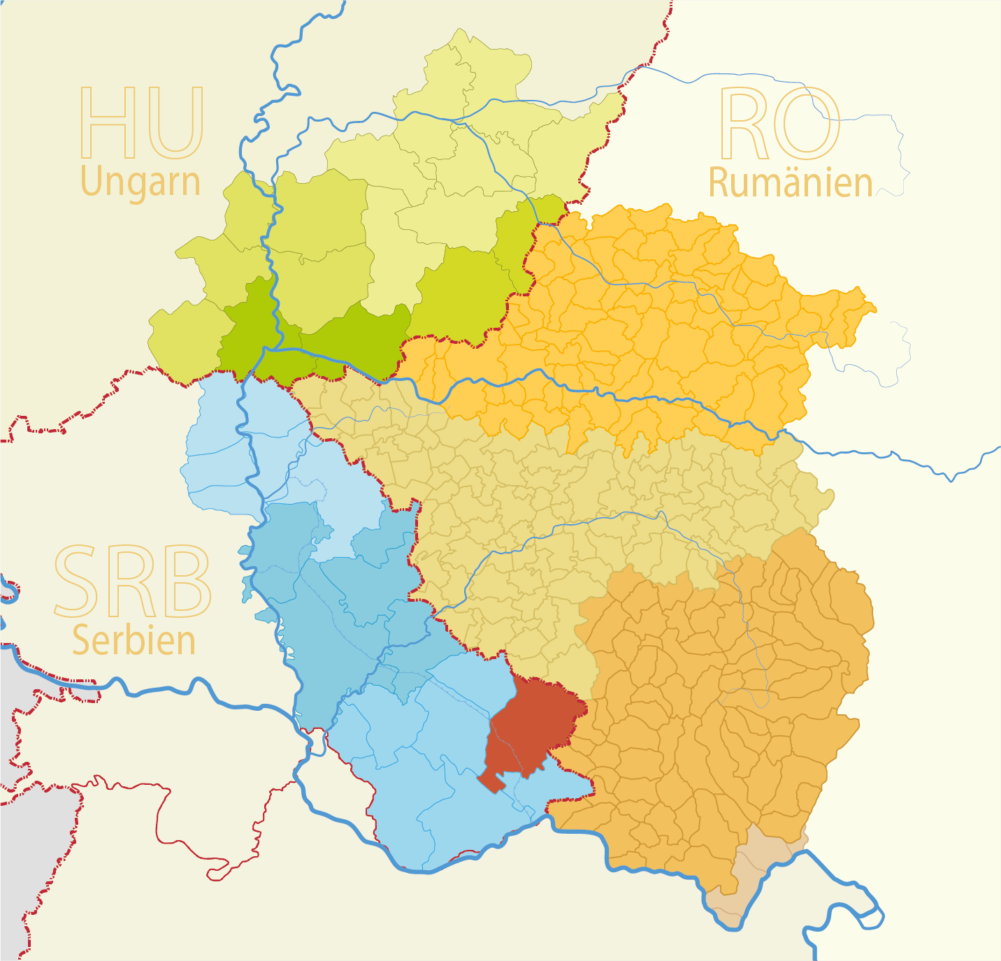
Map
Struktur und Verwaltung
Staat:
Serbien
Region:
Vojvodina
Kreis:
Južni Banat (Süd-Banat)
Gemeinde:
Gemeindeart:
Dorf
PLZ:
26345
Basisdaten
Koordinaten:
45° 1' 18" N
21° 14' 31" O
Höhe:
84 m
Fläche:
12.8 m²
Einwohner:
272
(2011)
343
(2002)
erste Erwähnung:
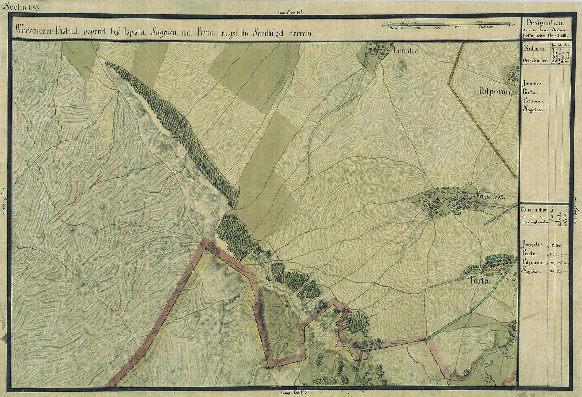
Karten
Quelle Wikipedia:
Josephinische Landesaufnahme Banat (1769–1772) Karte: pg154