Start typing & press "Enter" or "ESC" to close
EN
Deutsch
Home
Ortsverzeichnis
Fântânele
Engelsbrunn, Angyalkút, Kišfala, Кишфала
Spelling variants
Parochie
Sources
F%C3%A2nt%C3%A2nele_(Arad) - Wikipedia, Die freie Enzyklopädie (deutsch)
F%C3%A2nt%C3%A2nele,_Arad - Wikipedia, the free encyclopedia (english)
Fântânele, Arad - Wikipedia, enciclopedia liberă (română)
Angyalkút - Wikipédiában, Ezt az enciklopédiát (magyar)
Fântânele, Fântânele, Arad - Wikipediju, slobodnu enciklopediju (srpskohrvatsko)
Фантанеле (Арад) - Wikipediju, слободну енциклопедију
Fântânele
Engelsbrunn
Angyalkút
Kišfala
Кишфала
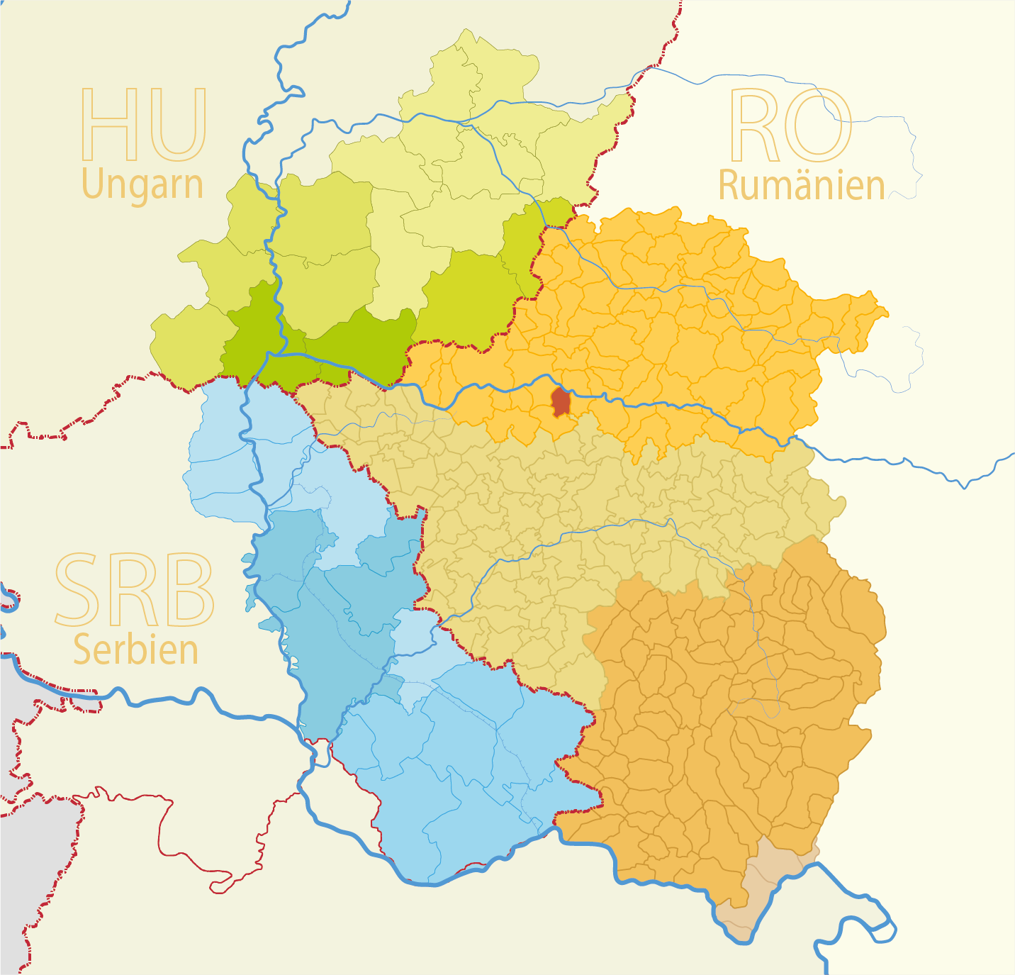
Map
Structure and administration
Country:
Romania
County:
Kreischgebiet
District:
Arad
Type of settlement:
Dorf
Postal code:
317120
Basic data
Coordinates:
46° 7' 26" N
21° 22' 51" O
Above sea level:
123 m
Area:
40.18 m²
Population:
2141
(2011)
2224
(2002)
first Dokumentation:
1457
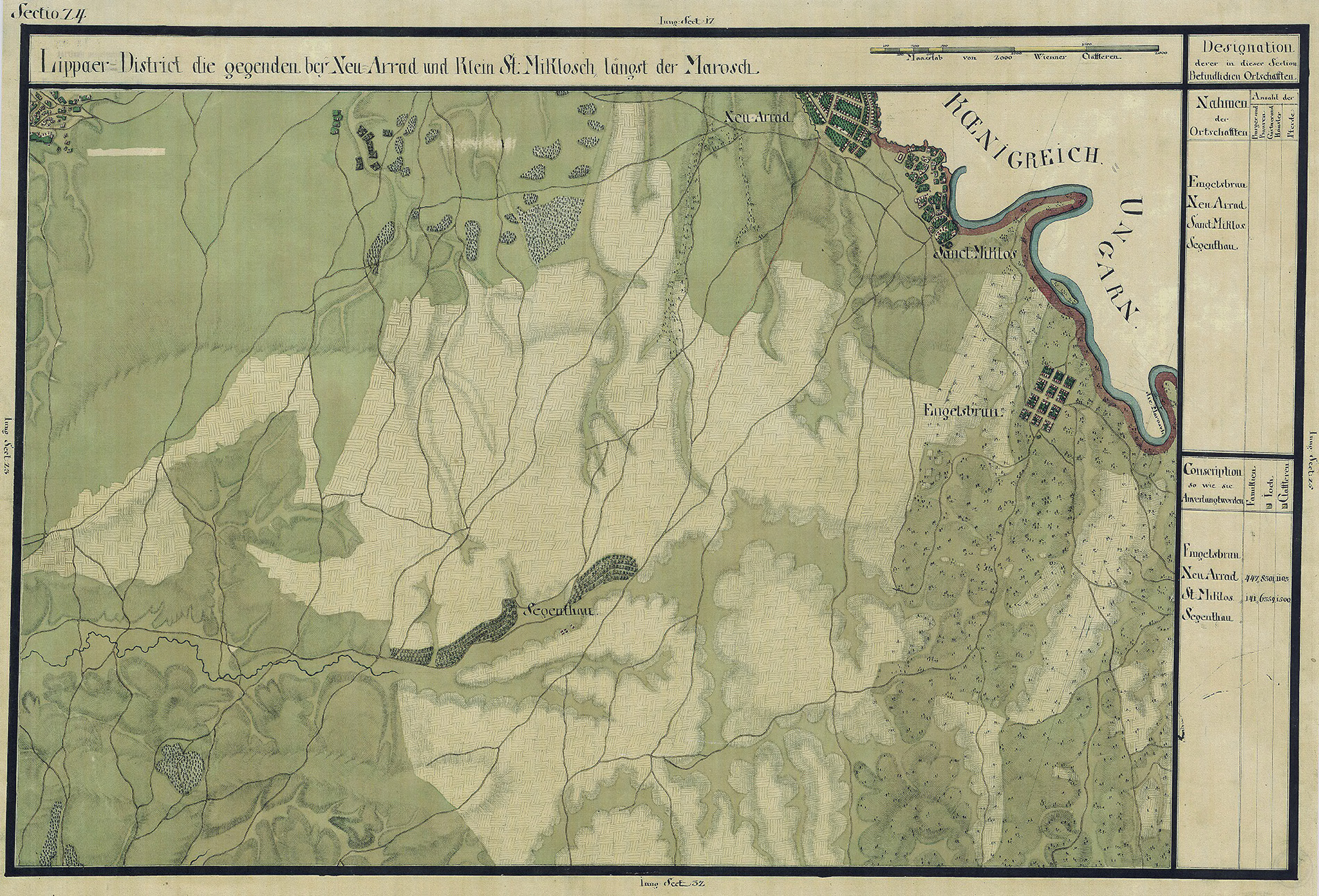
Maps
Quelle Wikipedia:
Josephinische Landesaufnahme Banat (1769–1772) Karte: pg024